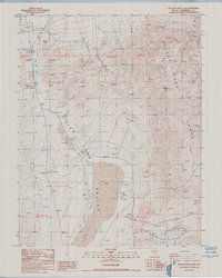
1987 Map of Rhyolite Ridge NW
USGS Topo · Published 1987About this map
Fish Lake Valley dominates this high-desert landscape in Esmeralda County, as it appeared in the late 1980s. The map captures the meeting point between the valley floor and the towering Silver Peak Range, anchored by Emigrant Peak in the north. This is a landscape shaped by resource extraction and water management, evidenced by the numerous prospect locations and an Open Pit Mine scattered across the arid slopes.
Find a feature on this map
21 named features on this map. Tap any name to fly to it.
Don’t see what you’re looking for? This feature index may not catch every label — zoom into the map to look around manually.
Map Details
Editions of this 1987 Rhyolite Ridge NW Map
This is the sole edition of this map. No revisions or reprints were ever made.
Other maps of this area

1898 · Silver Peak
USGS Topo · 1:125,000

1900 · Silver Peak
USGS Topo · 1:125,000

1907 · Tonopah
USGS Topo · 1:250,000

1908 · Lida
USGS Topo · 1:250,000

1908 · Tonopah
USGS Topo · 1:250,000

1909 · Hawthorne
USGS Topo · 1:250,000

1911 · Hawthorne
USGS Topo · 1:250,000

1913 · Lida
USGS Topo · 1:250,000

1915 · Hawthorne
USGS Topo · 1:250,000

1917 · White Mountain
USGS Topo · 1:125,000