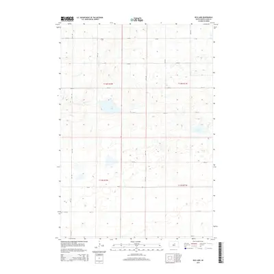
2015 Map of Rice Lake
USGS Topo · Published 2015About this map
Rice Lake and Baloun Lake anchor this Hyde County landscape, where the prairie is defined by natural depressions and intermittent watercourses. The drainage of Medicine Cr and Baloun Cr winds through the terrain, illustrating the hydrologic patterns of the High Plains. Organized by the Public Land Survey System, the area is partitioned into t116n r72w, t116n r71w, t115n r72w, and t115n r71w, creating a geometric grid of sections and section-line roads. A network of local routes, including CR-960 and CR-645, provides access to the remote township corners. The map reveals the sparse, agricultural character of the region, where the placement of section lines like 174th St and 181st St dictates the movement across this open country.
Find a feature on this map
17 named features on this map. Tap any name to fly to it.
Don’t see what you’re looking for? This feature index may not catch every label — zoom into the map to look around manually.
Map Details
Editions of this 2015 Rice Lake Map
This is the sole edition of this map. No revisions or reprints were ever made.
Other maps of this area

1949 · Mitchell Lake
USGS Topo · 1:24,000

1950 · Highmore NE
USGS Topo · 1:24,000

1950 · Mitchell Lake
USGS Topo · 1:24,000

1950 · Rezac Lake NE
USGS Topo · 1:24,000

1950 · Rezac Lake
USGS Topo · 1:24,000

1951 · Rezac Lake NE
USGS Topo · 1:24,000

1951 · Rice Lake
USGS Topo · 1:24,000

1951 · Rezac Lake
USGS Topo · 1:24,000

1951 · Rezac Lake NW
USGS Topo · 1:24,000

1953 · Huron
USGS Topo · 1:250,000