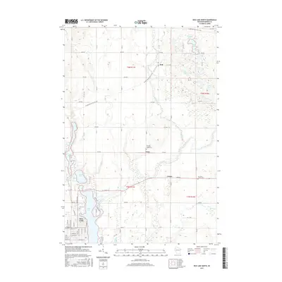
2015 Map of Rice Lake North
USGS Topo · Published 2015About this map
The Brill River and Red Cedar River meander through this northern Wisconsin landscape, converging just south of the small settlements of Brill and Campia. The northern reach of the city of Rice Lake occupies the southwestern corner, where the grid of residential streets including Linden Ave and Wisconsin Ave meets the shoreline of Rice Lake. This 2015 survey illustrates a rural terrain defined by its glacial history, with the Ice Age National Scenic Trail winding across the topography past numerous kettle lakes like Round Lake and Chain Lake. Local genealogy and community history are anchored by several notable sites, including the Nora Cem near the city center and rural churchyards such as Our Lady of Lourdes Catholic Cem in Dobie and Our Saviors Lutheran Cem to the east.
Find a feature on this map
66 named features on this map. Tap any name to fly to it.
Don’t see what you’re looking for? This feature index may not catch every label — zoom into the map to look around manually.
Map Details
Editions of this 2015 Rice Lake North Map
This is the sole edition of this map. No revisions or reprints were ever made.
Other maps of this area

1949 · Rice Lake
USGS Topo · 1:48,000

1951 · Shell Lake
USGS Topo · 1:48,000

1951 · Rice Lake
USGS Topo · 1:48,000

1951 · Chetek
USGS Topo · 1:62,500

1951 · Barron
USGS Topo · 1:62,500

1953 · Rice Lake
USGS Topo · 1:250,000

1959 · Rice Lake
USGS Topo · 1:250,000

1965 · Rice Lake
USGS Topo · 1:62,500

1965 · Shell Lake
USGS Topo · 1:62,500
1978 · Barron
USGS Topo · 1:24,000