
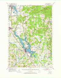
1951 Map of Chetek
USGS Topo · Published 1953About this map
The sprawling waters of Prairie Lake and Pokegama Lake dominate this mid-century portrait of northwestern Wisconsin, where the Chetek River drains south through the heart of the settlement at Chetek. The landscape is a mix of agricultural progress and rural education, documented by a high density of country schools like the Gregerson Sch and the Edgewood Sch. The arrival of the mid-1950s saw several of these local institutions transitioning, as evidenced by the Greenwood Sch (Abandoned) and Bass Lake Sch (Abandoned).
Find a feature on this map
99 named features on this map. Tap any name to fly to it.
Don’t see what you’re looking for? This feature index may not catch every label — zoom into the map to look around manually.
Map Details
Editions of this 1951 Chetek Map
2 editions found
Other maps of this area

1945 · Meteor
USGS Topo · 1:48,000

1948 · Weyerhauser
USGS Topo · 1:48,000

1949 · Meteor
USGS Topo · 1:48,000

1949 · Rice Lake
USGS Topo · 1:48,000

1949 · Bloomer
USGS Topo · 1:62,500

1949 · New Auburn
USGS Topo · 1:62,500

1949 · Ridgeland
USGS Topo · 1:62,500

1950 · Weyerhauser
USGS Topo · 1:48,000

1951 · Bloomer
USGS Topo · 1:62,500

1951 · Ridgeland
USGS Topo · 1:62,500