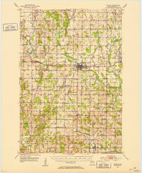
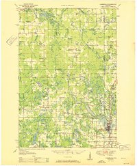
1951 Map of Barron
USGS Topo · Published 1953About this map
The Yellow River and Vermillion River systems define this mid-century landscape in Barron County, where a dense network of one-room schoolhouses and country churches served a burgeoning agricultural community. The city of Barron sits at the heart of the map, situated along the Minneapolis St Paul and Sault Ste Marie RR, which also connects smaller nodes like Poskin and Cameron. Rural life in the early 1950s is evidenced by the sheer density of named schools, such as the La Follette Sch, Arrandale Sch, and Yellow River Sch. This era captures a moment of transition where some facilities, such as the Coolidge Sch and Pershing Sch, were already labeled as abandoned, likely reflecting the consolidation of rural school districts. Genealogists will find significant value in the documentation of family-linked landmarks and burial grounds, including the Old Hillsdale Cem and the Sioux Creek Cem.
Find a feature on this map
122 named features on this map. Tap any name to fly to it.
Don’t see what you’re looking for? This feature index may not catch every label — zoom into the map to look around manually.
Map Details
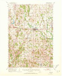
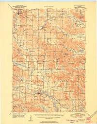
Editions of this 1951 Barron Map
2 editions found
Other maps of this area

1948 · Downing
USGS Topo · 1:62,500

1949 · Rice Lake
USGS Topo · 1:48,000

1949 · New Auburn
USGS Topo · 1:62,500
1949 · Ridgeland
USGS Topo · 1:62,500

1950 · Downing
USGS Topo · 1:62,500
1950 · Turtle Lake
USGS Topo · 1:62,500
1951 · Cumberland
USGS Topo · 1:48,000
1951 · Ridgeland
USGS Topo · 1:62,500
1951 · Shell Lake
USGS Topo · 1:48,000
1951 · Rice Lake
USGS Topo · 1:48,000