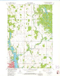
1981 Map of Rice Lake North
USGS Topo · Published 1982About this map
Rice Lake sits at the heart of this Northwoods landscape, where the Red Cedar River flows through a complex network of wetlands and glacial lakes. The city itself is a hub of community life, featuring Washington Jr High Sch, Jefferson Sch, and several civic landmarks including the Library and City Hall. Near the shoreline, Indian Mound Park and the Fairground provide public spaces, while the Indianhead Speedway serves as a local recreation destination.
Find a feature on this map
37 named features on this map. Tap any name to fly to it.
Don’t see what you’re looking for? This feature index may not catch every label — zoom into the map to look around manually.
Map Details
Editions of this 1981 Rice Lake North Map
This is the sole edition of this map. No revisions or reprints were ever made.
Other maps of this area

1949 · Rice Lake
USGS Topo · 1:48,000

1951 · Shell Lake
USGS Topo · 1:48,000

1951 · Rice Lake
USGS Topo · 1:48,000

1951 · Chetek
USGS Topo · 1:62,500

1951 · Barron
USGS Topo · 1:62,500

1953 · Rice Lake
USGS Topo · 1:250,000

1959 · Rice Lake
USGS Topo · 1:250,000

1965 · Rice Lake
USGS Topo · 1:62,500

1965 · Shell Lake
USGS Topo · 1:62,500
1978 · Barron
USGS Topo · 1:24,000