
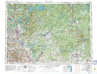
1953 Map of Rice Lake
USGS Topo · Published 1967About this map
Rice Lake and the river-fed settlements of Northwest Wisconsin define this landscape in the mid-1950s. The map illustrates the convergence of water and industry, with the Chippewa River and Flambeau River cutting through extensive timberlands and the Chequamegon National Forest. The regional economy is anchored by the Soo Line and Chicago and North Western railroads, which connected mill towns like Ladysmith and Cornell to wider markets. North of the developed agricultural lands around Bloomer and Chetek, the terrain shifts toward the dense woods of the Lac Courte Oreilles Indian Reservation and the sprawling Flambeau River State Forest. This survey captures the region just before significant modern highway expansion, showing the primary routes of Us 53 and Wis 64 as they served these lakeside and riverfront communities.
Find a feature on this map
48 named features on this map. Tap any name to fly to it.
Don’t see what you’re looking for? This feature index may not catch every label — zoom into the map to look around manually.
Map Details
Editions of this 1953 Rice Lake Map
2 editions found
Other maps of this area

1902 · Marathon
USGS Topo · 1:125,000

1934 · Elk Mound
USGS Topo · 1:62,500

1934 · Chippewa Falls
USGS Topo · 1:62,500

1936 · Chippewa Falls
USGS Topo · 1:62,500

1936 · Elk Mound
USGS Topo · 1:62,500

1938 · Lac Du Flambeau
USGS Topo · 1:48,000

1939 · Lac Du Flambeau
USGS Topo · 1:48,000

1939 · Mc Cord
USGS Topo · 1:48,000

1939 · Winchester
USGS Topo · 1:48,000

1940 · Mercer
USGS Topo · 1:48,000