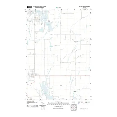
2010 Map of Rice Lake South
USGS Topo · Published 2010About this map
Prairie Lake and the Red Cedar River system define the southern Barron County landscape in this 2010 topographic survey. The area transitions from the urbanized southern edge of Rice Lake, featuring the Rice Lake Water Dam and Rice Lake Municipal Airport, into the rural corridors surrounding Cameron, Canton, and Sumner. The map reveals a high density of rural cemeteries, including Orchard Beach Cemetery and Pioneer Rest Cemetery, providing valuable data for genealogists tracing early families. The network of creeks, such as Pokegama Creek and Meadows Creek, illustrates the drainage patterns feeding into the larger lakes. Educational and civic landmarks like the University of Wisconsin campus and the Cameron Post Office are precisely situated within the local infrastructure.
Find a feature on this map
73 named features on this map. Tap any name to fly to it.
Don’t see what you’re looking for? This feature index may not catch every label — zoom into the map to look around manually.
Map Details
Editions of this 2010 Rice Lake South Map
This is the sole edition of this map. No revisions or reprints were ever made.
Other maps of this area

1949 · Rice Lake
USGS Topo · 1:48,000

1951 · Shell Lake
USGS Topo · 1:48,000

1951 · Rice Lake
USGS Topo · 1:48,000

1951 · Chetek
USGS Topo · 1:62,500

1951 · Barron
USGS Topo · 1:62,500

1953 · Rice Lake
USGS Topo · 1:250,000

1959 · Rice Lake
USGS Topo · 1:250,000

1965 · Rice Lake
USGS Topo · 1:62,500

1965 · Shell Lake
USGS Topo · 1:62,500
1978 · Barron
USGS Topo · 1:24,000