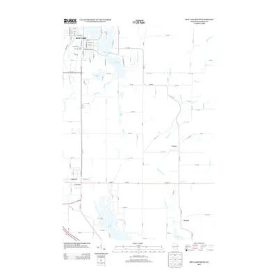
2013 Map of Rice Lake South
USGS Topo · Published 2013About this map
The Red Cedar River flows through this Barron County landscape, anchoring the southern portion of Rice Lake and the nearby villages of Cameron and Canton. In the early 21st century, the area shows a distinct transition from the grid-iron streets of the larger town—marked by landmarks like the Rice Lake Water Tower—to the surrounding lake-dotted wetlands and agricultural plots. Water dominates the geography, with Lake Montanis, Prairie Lake, and the smaller Dietz Lakes filling the glacial depressions typical of this part of Wisconsin.
Find a feature on this map
60 named features on this map. Tap any name to fly to it.
Don’t see what you’re looking for? This feature index may not catch every label — zoom into the map to look around manually.
Map Details
Editions of this 2013 Rice Lake South Map
This is the sole edition of this map. No revisions or reprints were ever made.
Other maps of this area

1949 · Rice Lake
USGS Topo · 1:48,000

1951 · Shell Lake
USGS Topo · 1:48,000

1951 · Rice Lake
USGS Topo · 1:48,000

1951 · Chetek
USGS Topo · 1:62,500

1951 · Barron
USGS Topo · 1:62,500

1953 · Rice Lake
USGS Topo · 1:250,000

1959 · Rice Lake
USGS Topo · 1:250,000

1965 · Rice Lake
USGS Topo · 1:62,500

1965 · Shell Lake
USGS Topo · 1:62,500
1978 · Barron
USGS Topo · 1:24,000