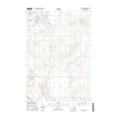
2015 Map of Rice Lake South
USGS Topo · Published 2015About this map
Rice Lake and the Red Cedar River corridor dominate this Barron County landscape, where the transition from urban settlement to glacial lakes defines the local geography. The southern edge of the city of Rice Lake gives way to a network of smaller water bodies including Moon Lake, Lake Montanis, and the Dietz Lakes. The map shows a high concentration of community burial sites like Saint Joseph Cem and Orchard Beach Cem, providing essential points of interest for genealogical research in the area.
Find a feature on this map
78 named features on this map. Tap any name to fly to it.
Don’t see what you’re looking for? This feature index may not catch every label — zoom into the map to look around manually.
Map Details
Editions of this 2015 Rice Lake South Map
This is the sole edition of this map. No revisions or reprints were ever made.
Other maps of this area

1949 · Rice Lake
USGS Topo · 1:48,000

1951 · Shell Lake
USGS Topo · 1:48,000

1951 · Rice Lake
USGS Topo · 1:48,000

1951 · Chetek
USGS Topo · 1:62,500

1951 · Barron
USGS Topo · 1:62,500

1953 · Rice Lake
USGS Topo · 1:250,000

1959 · Rice Lake
USGS Topo · 1:250,000

1965 · Rice Lake
USGS Topo · 1:62,500

1965 · Shell Lake
USGS Topo · 1:62,500
1978 · Barron
USGS Topo · 1:24,000