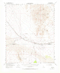
1954 Map of Rice
USGS Topo · Published 1964About this map
The Rice Air Base and its distinct triangular runway pattern dominate the desert floor of Rice Valley, serving as a focal point for this mid-century survey of the California desert borderlands. This landscape is defined by the intersection of critical infrastructure and harsh terrain, where the Atchison Topeka and Santa Fe railroad tracks run parallel to the Colorado River Aqueduct. Small railroad-dependent settlements like Rice, Freda, and Sablon dot the line, providing sparse human presence between the massive uplifts of the Turtle Mountains to the north and the Arica Mountains to the south.
Find a feature on this map
30 named features on this map. Tap any name to fly to it.
Don’t see what you’re looking for? This feature index may not catch every label — zoom into the map to look around manually.
Map Details
Editions of this 1954 Rice Map
2 editions found

Other maps of this area

1942 · Blythe
USGS Topo · 1:250,000

1942 · Amboy
USGS Topo · 1:250,000

1943 · Amboy
USGS Topo · 1:250,000

1943 · Turtle Mts.
USGS Topo · 1:62,500

1943 · Vidal
USGS Topo · 1:62,500

1943 · Iron Mountains
USGS Topo · 1:62,500

1945 · Big Maria Mtns
USGS Topo · 1:62,500

1945 · Midland
USGS Topo · 1:62,500

1949 · Vidal
USGS Topo · 1:62,500

1950 · Vidal
USGS Topo · 1:62,500