1947 Map of Rich
USGS Topo · Published 1966About this map
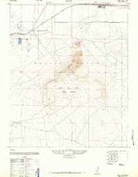
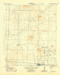
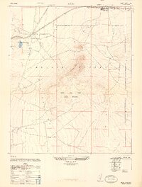
Leuhman Ridge rises sharply from the arid floor of the Mojave Desert in this post-war survey of the Kern County desert. The landscape is dominated by the sprawling Muroc Army Airfield Military Reservation, reflecting the region's mid-century importance for aviation and defense. The northern edge of the map features the established settlement of Boron and the rail-stop of Rich, both situated along the tracks of the Atchison Topeka and Santa Fe. This era represents a period of significant military expansion in the high desert, where the natural terrain of the Antelope Valley provided the open space necessary for testing. The map captures the intersection of industrial rail transport and secretive military activity, with many improved and unimproved dirt roads branching off toward the interior of the military reservation.
Find a feature on this map
8 named features on this map. Tap any name to fly to it.
Don’t see what you’re looking for? This feature index may not catch every label — zoom into the map to look around manually.
Map Details
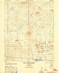
Editions of this 1947 Rich Map
2 editions found
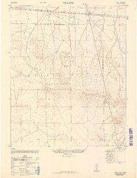
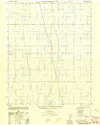
Other maps of this area

1915 · Searles Lake
USGS Topo · 1:250,000

1937 · Kramer
USGS Topo · 1:48,000
1937 · Rogers Lake
USGS Topo · 1:48,000
1942 · Kramer
USGS Topo · 1:62,500
1942 · Rogers Lake
USGS Topo · 1:62,500
1943 · Castle Butte
USGS Topo · 1:62,500
1947 · Castle Butte
USGS Topo · 1:50,000
1947 · Kramer
USGS Topo · 1:24,000
1947 · Johannesburg SE
USGS Topo · 1:25,000
1947 · Rich
USGS Topo · 1:24,000