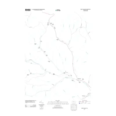
2013 Map of Rich Valley
USGS Topo · Published 2013About this map
Rich Valley and the small settlements of Lawn View and Lockwood occupy the valley floor where Clear Cr meets the Driftwood Br Sinnemahoning Cr. This 2013 landscape is characterized by a dense network of hollows and drafts that define the drainage of the North Cr watershed. The topography is deeply incised, with many of these narrow valleys bearing descriptive names like Oil Well Hollow, Sixmile Hollow, and High Dry Hollow, hinting at the historic patterns of resource extraction and local geography in this part of McKean County. To the southeast, the Emporium Reservoir serves as a significant hydrologic feature near Weber City. The road network, including Cooks Run Rd and N Creek Rd, follows the natural contours of the valley floors, providing access to the more remote upland areas of Chadwick Draft and Eighteen Hollow.
Find a feature on this map
62 named features on this map. Tap any name to fly to it.
Don’t see what you’re looking for? This feature index may not catch every label — zoom into the map to look around manually.
Map Details
Editions of this 2013 Rich Valley Map
This is the sole edition of this map. No revisions or reprints were ever made.
Other maps of this area

1941 · Benezette
USGS Topo · 1:62,500

1943 · Benezette
USGS Topo · 1:62,500

1945 · Driftwood
USGS Topo · 1:48,000

1945 · Cameron
USGS Topo · 1:24,000

1947 · Cameron
USGS Topo · 1:24,000

1948 · Crosby
USGS Topo · 1:62,500

1948 · Emporium
USGS Topo · 1:62,500

1948 · Keating Summit
USGS Topo · 1:24,000

1948 · Emporium
USGS Topo · 1:24,000

1948 · Wildwood Fire Tower
USGS Topo · 1:24,000
Featured Places
- Norwich Township, PA
- Weber City, Shippen Township
- Shippen Township, PA
- Lawn View, Shippen Township
- Lockwood, Shippen Township