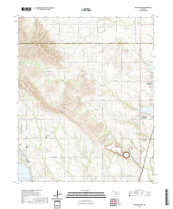
2022 Map of Richards Spur
USGS Topo · Published 2022About this map
The rolling landscape along the Comanche Co and Caddo Co border is defined by the significant hydrological systems of Lake Ellsworth and Lake Lawtonka. This 2022 survey captures the interface of rural residential expansion and conservation lands at the edge of the Wichita Mountains. Small communities like Edgewater Park, Lakeside Village, and Porter Hill anchor the eastern side of the quadrangle, while the western portion remains dominated by a network of drainage creeks including Chandler Cr, Ketch Cr, and Lime Cr.
Find a feature on this map
54 named features on this map. Tap any name to fly to it.
Don’t see what you’re looking for? This feature index may not catch every label — zoom into the map to look around manually.
Map Details
Editions of this 2022 Richards Spur Map
This is the sole edition of this map. No revisions or reprints were ever made.
Other maps of this area

1937 · Cache
USGS Topo · 1:48,000

1942 · Cache
USGS Topo · 1:62,500

1946 · Lawton
USGS Topo · 1:62,500

1949 · Mount Scott
USGS Topo · 1:24,000

1949 · Arbuckle Hill
USGS Topo · 1:24,000

1949 · Elgin
USGS Topo · 1:24,000

1949 · Fort Sill
USGS Topo · 1:24,000

1950 · Saddle Mountain
USGS Topo · 1:62,500

1955 · Lawton
USGS Topo · 1:250,000

1956 · Arbuckle Hill
USGS Topo · 1:24,000