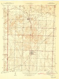
1942 Map of Richards
USGS Topo · Published 1942About this map
Richards and Stotesbury anchor this rural landscape along the Kansas Missouri border, where the agricultural plains of Richland and Henry townships meet a dense network of early transportation. The Kansas City Southern and Missouri Pacific railroads define the movement of goods and people during this era, cutting through a terrain drained by the Little Osage River and its many tributaries, including Pecan Creek and Wolf Creek.
Find a feature on this map
23 named features on this map. Tap any name to fly to it.
Don’t see what you’re looking for? This feature index may not catch every label — zoom into the map to look around manually.
Map Details
Editions of this 1942 Richards Map
3 editions found

Other maps of this area

1884 · Fort Scott
USGS Topo · 1:125,000

1886 · Nevada
USGS Topo · 1:125,000

1886 · Fort Scott
USGS Topo · 1:125,000

1887 · Butler
USGS Topo · 1:125,000

1887 · Mound City
USGS Topo · 1:125,000

1893 · Fort Scott
USGS Topo · 1:125,000

1893 · Mound City
USGS Topo · 1:125,000

1894 · Butler
USGS Topo · 1:125,000

1894 · Nevada
USGS Topo · 1:125,000

1938 · Metz
USGS Topo · 1:24,000