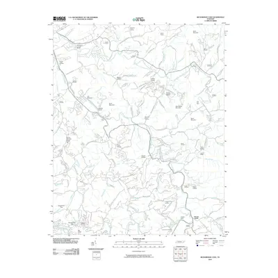
2010 Map of Richardson Cove
USGS Topo · Published 2010About this map
The Harrisburg Covered Bridge stands as a landmark over the East Fork Little Pigeon River, anchoring a landscape defined by its deep coves and numerous family burial grounds. This region of Sevier County reveals a dense network of mountain communities centered around Pittman Center and Emerts Cove. The topography is marked by distinctive elevations like Shields Mountain and Bearwallow Mountain, while the industrial history of the area is noted at the East Fork Mine. Local genealogists will find a wealth of records in the numerous well-preserved sites, including the Richardson Cove Cemetery, Catons Chapel Cemetery, and the Howard-Campbell Cemetery. This map provides a detailed view of the winding mountain roads and hollows, such as Swader Hollow and Happy Hollow, that have shaped the settlement patterns of these Tennessee highlands.
Find a feature on this map
136 named features on this map. Tap any name to fly to it.
Don’t see what you’re looking for? This feature index may not catch every label — zoom into the map to look around manually.
Map Details
Editions of this 2010 Richardson Cove Map
This is the sole edition of this map. No revisions or reprints were ever made.
Other maps of this area

1886 · Knoxville
USGS Topo · 1:125,000

1892 · Knoxville
USGS Topo · 1:125,000

1893 · Mt Guyot
USGS Topo · 1:125,000

1894 · Knoxville
USGS Topo · 1:125,000

1895 · Knoxville
USGS Topo · 1:125,000

1901 · Knoxville
USGS Topo · 1:125,000

1912 · Mt Guyot
USGS Topo · 1:125,000

1935 · English Mountain
USGS Topo · 1:48,000

1935 · Clevenger
USGS Topo · 1:24,000

1935 · Jones Cove
USGS Topo · 1:24,000