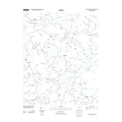
2013 Map of Richardson Cove
USGS Topo · Published 2013About this map
The Harrisburg Covered Bridge stands as a landmark crossing of the E Fork Little Pigeon River in this Tennessee landscape, where the valley floor transitions into a series of named ridges and hollows. The settlement pattern is defined by traditional cove communities and dispersed mountain hamlets such as Richardson Cove, Emerts Cove, and Crockettsville. This survey illustrates the intricate drainage network of the Smoky Mountain foothills, with Bird Cr, Powdermill Cr, and Webb Cr carving the terrain between summits like Shell Mountain and Shields Mountain. Local history and genealogy are anchored in these small valley pockets, from the clustered homes of Shady Grove and Zion Grove to the gap passages at Schoolhouse Gap and Boogertown Gap. The map details the transition from older routes like Old Newport Hwy to the more modern corridors serving Pittman Center.
Find a feature on this map
100 named features on this map. Tap any name to fly to it.
Don’t see what you’re looking for? This feature index may not catch every label — zoom into the map to look around manually.
Map Details
Editions of this 2013 Richardson Cove Map
This is the sole edition of this map. No revisions or reprints were ever made.
Other maps of this area

1886 · Knoxville
USGS Topo · 1:125,000

1892 · Knoxville
USGS Topo · 1:125,000

1893 · Mt Guyot
USGS Topo · 1:125,000

1894 · Knoxville
USGS Topo · 1:125,000

1895 · Knoxville
USGS Topo · 1:125,000

1901 · Knoxville
USGS Topo · 1:125,000

1912 · Mt Guyot
USGS Topo · 1:125,000

1935 · English Mountain
USGS Topo · 1:48,000

1935 · Clevenger
USGS Topo · 1:24,000

1935 · Jones Cove
USGS Topo · 1:24,000