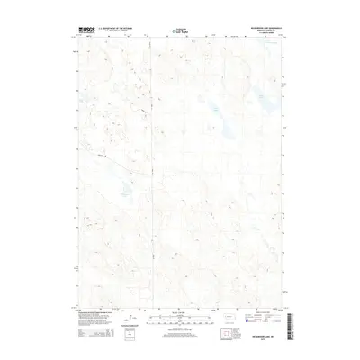
2014 Map of Richardson Lake
USGS Topo · Published 2014About this map
Richardson Lake and the surrounding Nebraska sandhills define this 2014 topographic study of Garden County. The landscape is characterized by its high concentration of natural basins and seasonal water bodies, including Horse Lake in the west and Lower Harrison Lake in the northeastern corner. This region is sparsely populated, with movement dictated by a simple grid of rural connectors such as Road 155 and Road 96. The arrangement of Twin Lake and Swan Lake reveals the internal drainage patterns typical of this undulating prairie environment. This survey captures the remote character of the High Plains, providing a clear record of the area's hydrology and secondary road networks as they existed in the early 21st century.
Find a feature on this map
8 named features on this map. Tap any name to fly to it.
Don’t see what you’re looking for? This feature index may not catch every label — zoom into the map to look around manually.
Map Details
Editions of this 2014 Richardson Lake Map
This is the sole edition of this map. No revisions or reprints were ever made.
Other maps of this area

1896 · Browns Creek
USGS Topo · 1:125,000

1899 · Browns Creek
USGS Topo · 1:125,000

1949 · Mumper
USGS Topo · 1:62,500

1950 · Crescent Lake
USGS Topo · 1:62,500

1950 · Storm Lake
USGS Topo · 1:62,500

1954 · Scottsbluff
USGS Topo · 1:250,000

1958 · Scottsbluff
USGS Topo · 1:250,000

1971 · Richardson Lake
USGS Topo · 1:24,000

1971 · Tar Valley SW
USGS Topo · 1:24,000
1971 · Buske Ranch
USGS Topo · 1:24,000