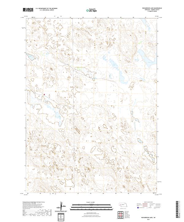
2021 Map of Richardson Lake
USGS Topo · Published 2021About this map
Swan Lake and the wetlands of Garden County define this high-plains landscape in the Nebraska Sandhills. Situated in the northeast corner of the quadrangle, this prominent water body is part of a complex hydrographic network that includes Horse Lake to the west and the central Twin Lake. The terrain is characterized by a high density of depressions and seasonal water features, characteristic of this cattle-ranching region. Human modification is largely limited to the section-line road network, including north-south corridors like Rd 155 and angled routes such as Rd 96 and Rd 100. These roads follow the township and range divisions of t20n r45w and t21n r46w, providing access through the dunes to the remote ranching operations and water resources essential to the local economy.
Find a feature on this map
12 named features on this map. Tap any name to fly to it.
Don’t see what you’re looking for? This feature index may not catch every label — zoom into the map to look around manually.
Map Details
Editions of this 2021 Richardson Lake Map
This is the sole edition of this map. No revisions or reprints were ever made.
Other maps of this area

1896 · Browns Creek
USGS Topo · 1:125,000

1899 · Browns Creek
USGS Topo · 1:125,000

1949 · Mumper
USGS Topo · 1:62,500

1950 · Crescent Lake
USGS Topo · 1:62,500

1950 · Storm Lake
USGS Topo · 1:62,500

1954 · Scottsbluff
USGS Topo · 1:250,000

1958 · Scottsbluff
USGS Topo · 1:250,000

1971 · Richardson Lake
USGS Topo · 1:24,000

1971 · Tar Valley SW
USGS Topo · 1:24,000
1971 · Buske Ranch
USGS Topo · 1:24,000