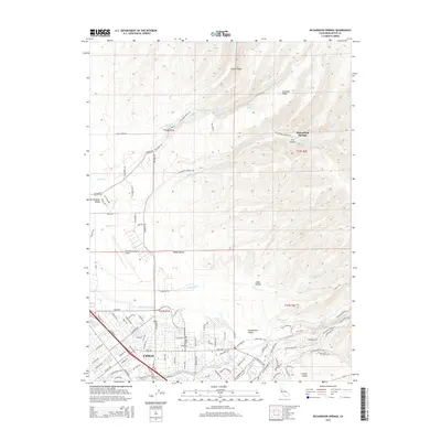
2015 Map of Richardson Springs
USGS Topo · Published 2015About this map
Richardson Springs sits at the edge of the foothills where the Sacramento Valley meets the rising terrain of Keefer Ridge and Cohasset Ridge. This northern Butte County landscape is defined by the drainage network of Mud Cr, Sycamore Cr, and Rock Cr, which flow from the higher elevations toward the alluvial plains. The southern portion of the map transition into the urbanized northern reaches of Chico, showing the modern residential grid and industrial infrastructure including the Chico Municipal Airport and the complex water management of the Lindo Channel. The rugged eastern canyons, such as Iron Canyon, contrast with the managed landscapes of the Central Valley. Local landmarks like Horseshoe Lake and the Cohasset Pioneers Spring highlight the historical importance of water sources in this region's development from a rural springs resort toward its present suburban character.
Find a feature on this map
104 named features on this map. Tap any name to fly to it.
Don’t see what you’re looking for? This feature index may not catch every label — zoom into the map to look around manually.
Map Details
Editions of this 2015 Richardson Springs Map
This is the sole edition of this map. No revisions or reprints were ever made.
Other maps of this area

1891 · Chico
USGS Topo · 1:125,000

1893 · Chico
USGS Topo · 1:125,000

1895 · Chico
USGS Topo · 1:125,000

1912 · Durham
USGS Topo · 1:31,680

1912 · Nord
USGS Topo · 1:31,680

1912 · Chico Landing
USGS Topo · 1:31,680

1912 · Keefers
USGS Topo · 1:31,680

1912 · Clear Creek
USGS Topo · 1:31,680

1912 · Singer Creek
USGS Topo · 1:31,680

1942 · Oroville
USGS Topo · 1:62,500