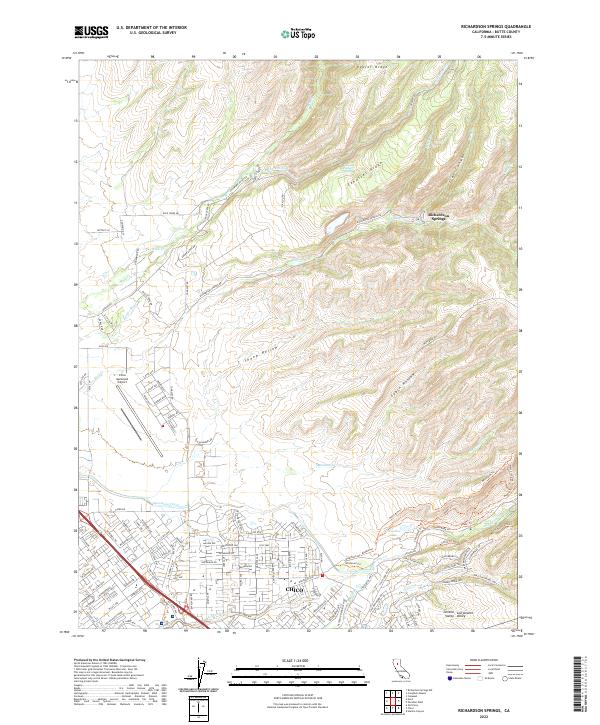
2022 Map of Richardson Springs
USGS Topo · Published 2022About this map
Chico expands northward into the foothills of the southern Cascades in this modern record of Butte County development. The map details the residential transition from the city's suburban edges toward the natural landmarks of the Sacramento Valley. To the north, the historic enclave of Richardson Springs sits tucked between Cohasset Ridge and the drainage of Mud Cr. The landscape is defined by the dramatic descent of watercourses like Big Chico Cr and Sycamore Creek as they move from the volcanic plateaus down toward the floor of the Central Valley. Infrastructure such as the Chico Municipal Airport and a complex network of fire roads and recreational paths, including the North Rim Trl near Horseshoe Lake, illustrate the region's contemporary mix of aviation industry, suburban growth, and protected parkland.
Find a feature on this map
127 named features on this map. Tap any name to fly to it.
Don’t see what you’re looking for? This feature index may not catch every label — zoom into the map to look around manually.
Map Details
Editions of this 2022 Richardson Springs Map
This is the sole edition of this map. No revisions or reprints were ever made.
Other maps of this area

1891 · Chico
USGS Topo · 1:125,000

1893 · Chico
USGS Topo · 1:125,000

1895 · Chico
USGS Topo · 1:125,000

1912 · Durham
USGS Topo · 1:31,680

1912 · Nord
USGS Topo · 1:31,680

1912 · Chico Landing
USGS Topo · 1:31,680

1912 · Keefers
USGS Topo · 1:31,680

1912 · Clear Creek
USGS Topo · 1:31,680

1912 · Singer Creek
USGS Topo · 1:31,680

1942 · Oroville
USGS Topo · 1:62,500