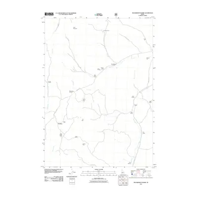
2011 Map of Richardson Summit
USGS Topo · Published 2011About this map
Mining operations and remote ranching define this high-country landscape in Blaine County. The terrain is marked by a legacy of extraction, with numerous workings including the Red Elephant Mine near the head of Red Elephant Gulch, and the Liberty Gem Mine situated along Liberty Gulch. These sites, along with the Apache Mill and Treasure Vault Mine, indicate a history of hard-rock exploration throughout the drainage basins of Croy Creek and Rock Creek.
Find a feature on this map
35 named features on this map. Tap any name to fly to it.
Don’t see what you’re looking for? This feature index may not catch every label — zoom into the map to look around manually.
Map Details
Editions of this 2011 Richardson Summit Map
This is the sole edition of this map. No revisions or reprints were ever made.
Other maps of this area

1895 · Hailey
USGS Topo · 1:125,000

1897 · Hailey
USGS Topo · 1:125,000

1900 · Sawtooth
USGS Topo · 1:125,000

1955 · Hailey
USGS Topo · 1:250,000

1957 · Bellevue
USGS Topo · 1:62,500

1957 · Blaine
USGS Topo · 1:62,500

1957 · Bellevue
USGS Topo · 1:24,000

1959 · Hailey
USGS Topo · 1:250,000

1962 · Hailey
USGS Topo · 1:250,000

1967 · Mahoney Butte
USGS Topo · 1:24,000