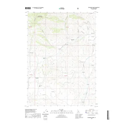
2020 Map of Richardson Summit
USGS Topo · Published 2020About this map
Doniphan sits at the edge of the high mountain terrain in this 2020 study of the northern reaches of Camas Flats and the southern Sawtooth National Forest. The landscape is defined by the transition from the relatively level southern plains into the complex drainage systems of the Wood River valley watershed. Significant topographic points include the titular Richardson Summit, which marks a dividing line between the Croy Cr and Camp Cr systems. The map reveals an intricate network of narrow gulches and canyons, such as Red Elephant Gulch, Jumbo Canyon, and Black Cinder Gulch, reflecting a history of access and exploration. These named features, along with the high peak of Kelly Mtn, illustrate the geologic diversity of the region where sagebrush plains meet the rising foothills of the Pioneer Mountains.
Find a feature on this map
44 named features on this map. Tap any name to fly to it.
Don’t see what you’re looking for? This feature index may not catch every label — zoom into the map to look around manually.
Map Details
Editions of this 2020 Richardson Summit Map
This is the sole edition of this map. No revisions or reprints were ever made.
Other maps of this area

1895 · Hailey
USGS Topo · 1:125,000

1897 · Hailey
USGS Topo · 1:125,000

1900 · Sawtooth
USGS Topo · 1:125,000

1955 · Hailey
USGS Topo · 1:250,000

1957 · Bellevue
USGS Topo · 1:62,500

1957 · Blaine
USGS Topo · 1:62,500

1957 · Bellevue
USGS Topo · 1:24,000

1959 · Hailey
USGS Topo · 1:250,000

1962 · Hailey
USGS Topo · 1:250,000

1967 · Mahoney Butte
USGS Topo · 1:24,000