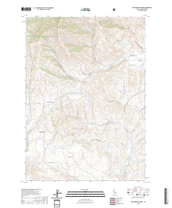
2024 Map of Richardson Summit
USGS Topo · Published 2024About this map
Sawtooth National Forest dominates the high-elevation terrain of this Blaine County landscape, where the northern slopes of the Smoky Mountains rise toward Kelly Mtn. The map centers on the topographic transition at Richardson Summit, a key point in the local drainage network that separates the headwaters of several drainages. To the south, the terrain levels out into Camas Flats, while the northern and eastern sections are deeply incised by a system of gulches and canyons including Bullion Gulch, Red Elephant Gulch, and Kent Canyon. The small settlement of Doniphan sits in the west-central portion of the quadrangle, illustrating the historical footprint of mining or ranching activity near the intersection of Camp Creek Rd and Poison Creek Rd. Transport patterns follow the natural contours of the land, with Croy Creek Rd tracing the valley floor eastward toward Gilman Flat.
Find a feature on this map
45 named features on this map. Tap any name to fly to it.
Don’t see what you’re looking for? This feature index may not catch every label — zoom into the map to look around manually.
Map Details
Editions of this 2024 Richardson Summit Map
This is the sole edition of this map. No revisions or reprints were ever made.
Other maps of this area

1895 · Hailey
USGS Topo · 1:125,000

1897 · Hailey
USGS Topo · 1:125,000

1900 · Sawtooth
USGS Topo · 1:125,000

1955 · Hailey
USGS Topo · 1:250,000

1957 · Bellevue
USGS Topo · 1:62,500

1957 · Blaine
USGS Topo · 1:62,500

1957 · Bellevue
USGS Topo · 1:24,000

1959 · Hailey
USGS Topo · 1:250,000

1962 · Hailey
USGS Topo · 1:250,000

1967 · Mahoney Butte
USGS Topo · 1:24,000