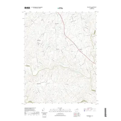
2019 Map of Richardsville
USGS Topo · Published 2019About this map
The Rappahannock River winds through this landscape, serving as a defining boundary between several Virginia counties including Fauquier, Culpeper, and Stafford. This rural corridor is characterized by small established settlements like Richardsville, Goldvein, and Sumerduck, each linked by a network of local roads that trace the undulating topography of the Culpeper Basin. The names on the land hint at the area's mineral history, with features such as Goldmine Rd, Gold Rush Ln, and Mine Run appearing near the community of Goldvein. Genealogical interest is anchored by the Embrey Cem near the town of Sumerduck. Waterways like Sumerduck Run and Hazel Run drain the terrain toward the main river channel, while the southern edge of the map captures the confluence-rich area near the Ranidan River.
Find a feature on this map
95 named features on this map. Tap any name to fly to it.
Don’t see what you’re looking for? This feature index may not catch every label — zoom into the map to look around manually.
Map Details
Editions of this 2019 Richardsville Map
This is the sole edition of this map. No revisions or reprints were ever made.
Other maps of this area

1887 · Spottsylvania
USGS Topo · 1:125,000

1892 · Spottsylvania
USGS Topo · 1:125,000

1894 · Warrenton
USGS Topo · 1:125,000

1894 · Warrenton
USGS Topo · 1:62,500

1927 · Remington
USGS Topo · 1:48,000

1930 · Warrenton
USGS Topo · 1:62,500

1943 · Catlett
USGS Topo · 1:62,500

1943 · Germanna Bridge
USGS Topo · 1:24,000

1943 · Chancellorsville
USGS Topo · 1:24,000

1943 · Salem Church
USGS Topo · 1:24,000