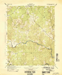
1944 Map of Richardsville
USGS Topo · Published 1944About this map
The Rappahannock River and Rapidan River converge at the heart of this mid-century survey, defining the rugged borders of Fauquier, Culpeper, and Stafford counties. The landscape is dotted with several rural settlements including Morrisville, Summerduck, and Richardsville, alongside the aptly named Goldvein, which hints at the region's mining history. Several Sawmill sites and a Mine are noted, showing a local economy still tied closely to natural resource extraction during the war years.
Find a feature on this map
23 named features on this map. Tap any name to fly to it.
Don’t see what you’re looking for? This feature index may not catch every label — zoom into the map to look around manually.
Map Details
Editions of this 1944 Richardsville Map
This is the sole edition of this map. No revisions or reprints were ever made.
Other maps of this area

1887 · Spottsylvania
USGS Topo · 1:125,000

1892 · Spottsylvania
USGS Topo · 1:125,000

1894 · Warrenton
USGS Topo · 1:125,000

1894 · Warrenton
USGS Topo · 1:62,500

1927 · Remington
USGS Topo · 1:48,000

1930 · Warrenton
USGS Topo · 1:62,500

1943 · Catlett
USGS Topo · 1:62,500

1943 · Germanna Bridge
USGS Topo · 1:24,000

1943 · Chancellorsville
USGS Topo · 1:24,000

1943 · Salem Church
USGS Topo · 1:24,000