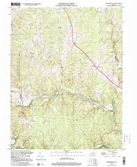
1998 Map of Richardsville
USGS Topo · Published 2001About this map
The Rappahannock River and Rapidan River wind through this Piedmont landscape at the intersection of Fauquier, Culpeper, and Stafford counties. The terrain is defined by a dense network of drainage runs, including Sumerduck Run and Marsh Run, which have historically dictated the placement of small rural communities. These settlements, such as Richardsville, Goldvein, and Sumerduck, are connected by a system of ridge-top roads.
Find a feature on this map
30 named features on this map. Tap any name to fly to it.
Don’t see what you’re looking for? This feature index may not catch every label — zoom into the map to look around manually.
Map Details
Editions of this 1998 Richardsville Map
This is the sole edition of this map. No revisions or reprints were ever made.
Other maps of this area

1887 · Spottsylvania
USGS Topo · 1:125,000

1892 · Spottsylvania
USGS Topo · 1:125,000

1894 · Warrenton
USGS Topo · 1:125,000

1894 · Warrenton
USGS Topo · 1:62,500

1927 · Remington
USGS Topo · 1:48,000

1930 · Warrenton
USGS Topo · 1:62,500

1943 · Catlett
USGS Topo · 1:62,500

1943 · Germanna Bridge
USGS Topo · 1:24,000

1943 · Chancellorsville
USGS Topo · 1:24,000

1943 · Salem Church
USGS Topo · 1:24,000