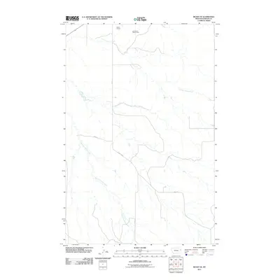
2011 Map of Richey SE
USGS Topo · Published 2011About this map
West Fork Pasture Creek and East Fork Pasture Creek define the drainage patterns of this prairie landscape in Dawson County. The terrain is marked by the infrastructure of ranching and light aviation, notably the Johnstone Pasture Dam and the Richey Airport located near the northern boundary. A network of section-line and local roads, including County Rd 431 and Road 412, provides access across the open country, tracing the path of rural development in eastern Montana. This survey captures the region as it functioned in the early twenty-first century, showing the intersection of natural waterways and the essential transport links required for remote agricultural operations.
Find a feature on this map
8 named features on this map. Tap any name to fly to it.
Don’t see what you’re looking for? This feature index may not catch every label — zoom into the map to look around manually.
Map Details
Editions of this 2011 Richey SE Map
This is the sole edition of this map. No revisions or reprints were ever made.
Other maps of this area

1909 · Glendive
USGS Topo · 1:250,000

1954 · Glendive
USGS Topo · 1:250,000

1957 · Glendive
USGS Topo · 1:250,000

1958 · Glendive
USGS Topo · 1:250,000

1972 · Clay Butte
USGS Topo · 1:24,000

1972 · Kuester Lake
USGS Topo · 1:24,000

1972 · Bloomfield
USGS Topo · 1:24,000

1981 · Glendive
USGS Topo · 1:100,000

1981 · Sidney
USGS Topo · 1:100,000

1982 · Circle
USGS Topo · 1:100,000