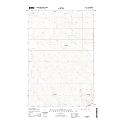
2014 Map of Richey SE
USGS Topo · Published 2014About this map
Big Sheep Mountains dominate the southeastern corner of this Dawson County landscape, where the high plains of eastern Montana are carved by seasonal drainage systems. The hydrologic character of the region is defined by the diverging paths of E Fork Pasture Cr and W Fork Pasture Cr, which navigate the undulating breaks and coulees typical of this ranching country. Transportation is anchored by MT-200 in the northwest, which serves as the primary artery connecting the rural sections. The presence of the Richey Airport indicates the region's reliance on aerial access for large-scale agricultural operations and local connectivity. A network of section-line roads, including Road 431 and Road 439, creates a geometric grid across the township and range divisions, reflecting the systematic land survey and settlement patterns of the American West.
Find a feature on this map
15 named features on this map. Tap any name to fly to it.
Don’t see what you’re looking for? This feature index may not catch every label — zoom into the map to look around manually.
Map Details
Editions of this 2014 Richey SE Map
This is the sole edition of this map. No revisions or reprints were ever made.
Other maps of this area

1909 · Glendive
USGS Topo · 1:250,000

1954 · Glendive
USGS Topo · 1:250,000

1957 · Glendive
USGS Topo · 1:250,000

1958 · Glendive
USGS Topo · 1:250,000

1972 · Clay Butte
USGS Topo · 1:24,000

1972 · Kuester Lake
USGS Topo · 1:24,000

1972 · Bloomfield
USGS Topo · 1:24,000

1981 · Glendive
USGS Topo · 1:100,000

1981 · Sidney
USGS Topo · 1:100,000

1982 · Circle
USGS Topo · 1:100,000