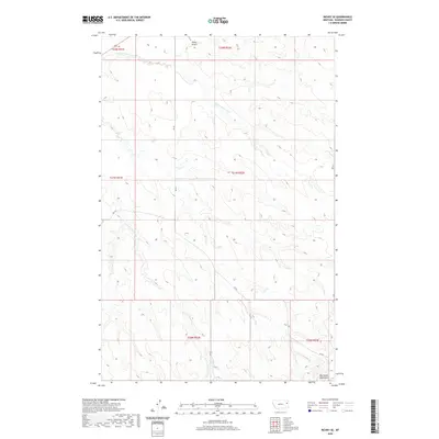
2020 Map of Richey SE
USGS Topo · Published 2020About this map
The Big Sheep Mountains anchor the southeastern corner of this landscape, marking a prominent topographic shift in an area otherwise defined by the complex drainage systems of E Fork Pasture Cr and W Fork Pasture Cr. In the north, the Richey Airport serves as a modern waypoint near the northern boundary. This 2020 survey illustrates the rural infrastructure of Dawson County, where a network of section-line roads such as RD 431 and RD 439 provides access across a terrain dominated by wide pasture lands. The map details the Public Land Survey System grid with precision, outlining townships like t21n r52e and t20n r52e, reflecting the enduring surveyor's framework that dictates the placement of homesteads and grazing tracts in this part of eastern Montana.
Find a feature on this map
15 named features on this map. Tap any name to fly to it.
Don’t see what you’re looking for? This feature index may not catch every label — zoom into the map to look around manually.
Map Details
Editions of this 2020 Richey SE Map
This is the sole edition of this map. No revisions or reprints were ever made.
Other maps of this area

1909 · Glendive
USGS Topo · 1:250,000

1954 · Glendive
USGS Topo · 1:250,000

1957 · Glendive
USGS Topo · 1:250,000

1958 · Glendive
USGS Topo · 1:250,000

1972 · Clay Butte
USGS Topo · 1:24,000

1972 · Kuester Lake
USGS Topo · 1:24,000

1972 · Bloomfield
USGS Topo · 1:24,000

1981 · Glendive
USGS Topo · 1:100,000

1981 · Sidney
USGS Topo · 1:100,000

1982 · Circle
USGS Topo · 1:100,000