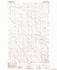
1983 Map of Richey SE
USGS Topo · Published 1983About this map
Richey Airport sits at the northern edge of this landscape in Dawson County, serving as a primary landmark in a region defined by its drainage systems. The terrain is deeply carved by the East Fork Pasture Creek and the West Fork Pasture Creek, which dominate the central and southern portions of the quadrangle. These waterways create a complex network of coulees and ridges typical of the Montana plains. Survey markers like BM 2522 and BM 2557 provide specific elevation data points across the undulating surface. This 1983 provisional edition, based on earlier aerial photography, captures the rural character of the area where Township and Range boundaries meet, highlighting the sparse but deliberate infrastructure required for aviation and land management in this part of the state.
Find a feature on this map
7 named features on this map. Tap any name to fly to it.
Don’t see what you’re looking for? This feature index may not catch every label — zoom into the map to look around manually.
Map Details
Editions of this 1983 Richey SE Map
This is the sole edition of this map. No revisions or reprints were ever made.
Other maps of this area

1909 · Glendive
USGS Topo · 1:250,000

1954 · Glendive
USGS Topo · 1:250,000

1957 · Glendive
USGS Topo · 1:250,000

1958 · Glendive
USGS Topo · 1:250,000

1972 · Clay Butte
USGS Topo · 1:24,000

1972 · Kuester Lake
USGS Topo · 1:24,000

1972 · Bloomfield
USGS Topo · 1:24,000

1981 · Glendive
USGS Topo · 1:100,000

1981 · Sidney
USGS Topo · 1:100,000

1982 · Circle
USGS Topo · 1:100,000