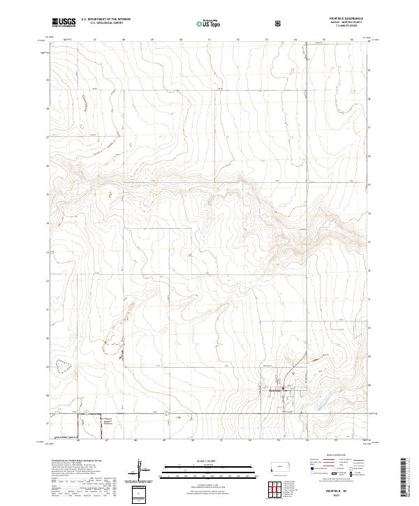
2022 Map of Richfield
USGS Topo · Published 2022About this map
Richfield serves as the focal point of this southwestern Kansas landscape, situated near the winding course of the N Fork Cimarron River. The town's grid is clearly defined by local thoroughfares such as Main St, Walnut St, and Oak St, while the broader regional connectivity is maintained through a network of lettered and numbered rural roads like BB RD and Co RD 11.
Find a feature on this map
26 named features on this map. Tap any name to fly to it.
Don’t see what you’re looking for? This feature index may not catch every label — zoom into the map to look around manually.
Map Details
Editions of this 2022 Richfield Map
This is the sole edition of this map. No revisions or reprints were ever made.
Other maps of this area

1955 · Dodge City
USGS Topo · 1:250,000

1958 · Dodge City
USGS Topo · 1:250,000

1959 · Dodge City
USGS Topo · 1:250,000

1973 · Richfield NW
USGS Topo · 1:24,000

1973 · Shore Airport SW
USGS Topo · 1:24,000

1973 · Shore Airport
USGS Topo · 1:24,000

1973 · Rolla NW
USGS Topo · 1:24,000

1973 · Richfield NE
USGS Topo · 1:24,000

1973 · Elkhart NE
USGS Topo · 1:24,000
1973 · Richfield SW
USGS Topo · 1:24,000