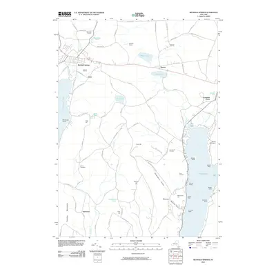
2010 Map of Richfield Springs
USGS Topo · Published 2010About this map
Richfield Springs serves as the primary hub in this central New York landscape, situated at a junction of roads and waterways that define the region's character. The village is flanked by Canadarago Lake to the west and the northern reaches of Otsego Lake to the east, illustrating a settlement pattern deeply tied to the glacial valley system. Significant genealogical markers are scattered throughout the hills, including Lakeview Cemetery and the Thurston Hill Cemetery near Springfield Center.
Find a feature on this map
95 named features on this map. Tap any name to fly to it.
Don’t see what you’re looking for? This feature index may not catch every label — zoom into the map to look around manually.
Map Details
Editions of this 2010 Richfield Springs Map
This is the sole edition of this map. No revisions or reprints were ever made.
Other maps of this area

1903 · Richfield Springs
USGS Topo · 1:62,500

1907 · Winfield
USGS Topo · 1:62,500

1907 · Cooperstown
USGS Topo · 1:62,500

1909 · Cooperstown
USGS Topo · 1:62,500

1910 · Hartwick
USGS Topo · 1:62,500

1912 · Hartwick
USGS Topo · 1:62,500

1943 · Schuyler Lake
USGS Topo · 1:24,000

1943 · Jordanville
USGS Topo · 1:24,000

1943 · Richfield Springs
USGS Topo · 1:24,000

1943 · Westford
USGS Topo · 1:24,000