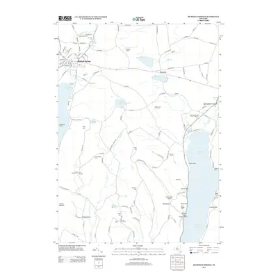
2013 Map of Richfield Springs
USGS Topo · Published 2013About this map
Richfield Springs serves as the primary hub of this northern Otsego County landscape, situated at the head of Canadarago Lake. The village is dense with local history, marked by the Presbyterian Cem and Lakeview Cem, while the surrounding hills are dotted with family-named burial grounds like Marshall Cem and Thurston Hill Cem. To the east, the map captures the northern reaches of Otsego Lake, featuring shoreline landmarks such as Sixmile Point and Hutter Point. The terrain between the lakes is defined by prominent elevations including Rum Hill and Metcalf Hill, which overlook a network of small water bodies like Weaver Lake and Young Lake. This region maintains a mix of agricultural and recreational character, evidenced by the Vaughns Poultry Farm and the Meadow Links Golf Course, illustrating the transition from traditional farming to modern rural use in the early twenty-first century.
Find a feature on this map
127 named features on this map. Tap any name to fly to it.
Don’t see what you’re looking for? This feature index may not catch every label — zoom into the map to look around manually.
Map Details
Editions of this 2013 Richfield Springs Map
This is the sole edition of this map. No revisions or reprints were ever made.
Other maps of this area

1903 · Richfield Springs
USGS Topo · 1:62,500

1907 · Winfield
USGS Topo · 1:62,500

1907 · Cooperstown
USGS Topo · 1:62,500

1909 · Cooperstown
USGS Topo · 1:62,500

1910 · Hartwick
USGS Topo · 1:62,500

1912 · Hartwick
USGS Topo · 1:62,500

1943 · Schuyler Lake
USGS Topo · 1:24,000

1943 · Jordanville
USGS Topo · 1:24,000

1943 · Richfield Springs
USGS Topo · 1:24,000

1943 · Westford
USGS Topo · 1:24,000