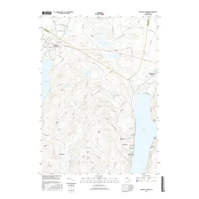
2016 Map of Richfield Springs
USGS Topo · Published 2016About this map
Richfield Springs serves as a primary hub for this portion of the northern Susquehanna River headwaters region, situated between the north shores of Canadarago Lake and the upper reaches of Otsego Lake. The map reveals a landscape defined by glacial topography, featuring numerous water bodies such as Weaver Lake, Young Lake, and Allen Lake, alongside prominent elevations like Rum Hill and Metcalf Hill.
Find a feature on this map
108 named features on this map. Tap any name to fly to it.
Don’t see what you’re looking for? This feature index may not catch every label — zoom into the map to look around manually.
Map Details
Editions of this 2016 Richfield Springs Map
This is the sole edition of this map. No revisions or reprints were ever made.
Other maps of this area

1903 · Richfield Springs
USGS Topo · 1:62,500

1907 · Winfield
USGS Topo · 1:62,500

1907 · Cooperstown
USGS Topo · 1:62,500

1909 · Cooperstown
USGS Topo · 1:62,500

1910 · Hartwick
USGS Topo · 1:62,500

1912 · Hartwick
USGS Topo · 1:62,500

1943 · Schuyler Lake
USGS Topo · 1:24,000

1943 · Jordanville
USGS Topo · 1:24,000

1943 · Richfield Springs
USGS Topo · 1:24,000

1943 · Westford
USGS Topo · 1:24,000