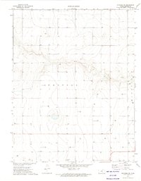
1973 Map of Richfield SW
USGS Topo · Published 1975About this map
Westola defines the central character of this southwestern Kansas landscape, captured during a 1972 aerial survey and field-checked the following year. This portion of Morton County is defined by its industrial transition, dominated by a systematic network of energy extraction across the High Plains. Dozens of sites marked Gas Well are peppered throughout the sections, illustrating the extensive development of the Hugoton Gas Area during the early 1970s. The terrain is marked by the winding depressions of dry creek beds and draws that cut through the shortgrass prairie, providing a stark contrast to the rigid grid of section lines and access roads that support the local gas economy. This map serves as a precise record of the infrastructure and land use in a sparsely populated corner of the state where the subterranean resources dictate the surface landscape.
Find a feature on this map
2 named features on this map. Tap any name to fly to it.
Don’t see what you’re looking for? This feature index may not catch every label — zoom into the map to look around manually.
Map Details
Editions of this 1973 Richfield SW Map
This is the sole edition of this map. No revisions or reprints were ever made.
Other maps of this area

1892 · Vilas
USGS Topo · 1:125,000

1955 · La Junta
USGS Topo · 1:250,000

1955 · Dodge City
USGS Topo · 1:250,000

1958 · La Junta
USGS Topo · 1:250,000

1958 · Dodge City
USGS Topo · 1:250,000

1959 · Dodge City
USGS Topo · 1:250,000

1968 · La Junta
USGS Topo · 1:250,000

1973 · Richfield NW
USGS Topo · 1:24,000

1973 · Richfield NE
USGS Topo · 1:24,000

1973 · Elkhart NE
USGS Topo · 1:24,000