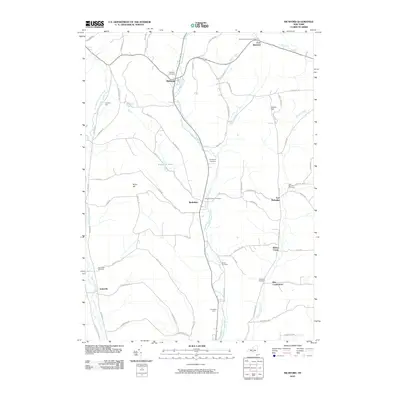
2010 Map of Richford
USGS Topo · Published 2010About this map
East Branch Owego Creek and West Branch Owego Creek define the valley-and-hill geography of Tioga County in this detailed record of the northern Susquehanna River watershed. The settlement pattern follows these watercourses, with the primary village of Berkshire situated along the central valley floor. Local history and genealogy are well-represented by a high density of burial grounds, including the Holcombville Church Cemetery near East Richford and the centrally located Evergreen Cemetery.
Find a feature on this map
66 named features on this map. Tap any name to fly to it.
Don’t see what you’re looking for? This feature index may not catch every label — zoom into the map to look around manually.
Map Details
Editions of this 2010 Richford Map
This is the sole edition of this map. No revisions or reprints were ever made.
Other maps of this area

1900 · Dryden
USGS Topo · 1:62,500

1901 · Apalachin
USGS Topo · 1:62,500

1903 · Owego
USGS Topo · 1:62,500

1903 · Harford
USGS Topo · 1:62,500

1904 · Apalachin
USGS Topo · 1:62,500

1906 · Catatonk
USGS Topo · 1:125,000
1949 · Dryden
USGS Topo · 1:24,000

1949 · Speedsville
USGS Topo · 1:24,000
1949 · Harford
USGS Topo · 1:24,000
1949 · Lisle
USGS Topo · 1:24,000