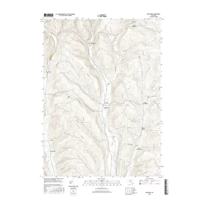
2016 Map of Richford
USGS Topo · Published 2016About this map
Richford and Berkshire anchor this valley landscape, where the East Branch Owego Creek dictates the path of settlement and transportation. The map reveals a high density of rural burial grounds, including the Railroad Avenue Cem and Evergreen Cem, which suggest long-established family lineages in the area. These small cemeteries often sit at the foot of rising terrain like Turkey Hill or Nixon Hill, marking the transition between agricultural bottomlands and more wooded upland slopes.
Find a feature on this map
68 named features on this map. Tap any name to fly to it.
Don’t see what you’re looking for? This feature index may not catch every label — zoom into the map to look around manually.
Map Details
Editions of this 2016 Richford Map
This is the sole edition of this map. No revisions or reprints were ever made.
Other maps of this area

1900 · Dryden
USGS Topo · 1:62,500

1901 · Apalachin
USGS Topo · 1:62,500

1903 · Owego
USGS Topo · 1:62,500

1903 · Harford
USGS Topo · 1:62,500

1904 · Apalachin
USGS Topo · 1:62,500

1906 · Catatonk
USGS Topo · 1:125,000
1949 · Dryden
USGS Topo · 1:24,000

1949 · Speedsville
USGS Topo · 1:24,000
1949 · Harford
USGS Topo · 1:24,000
1949 · Lisle
USGS Topo · 1:24,000