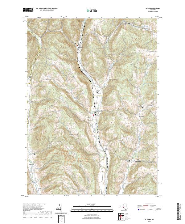
2023 Map of Richford
USGS Topo · Published 2023About this map
The northern valley of East Branch Owego Creek anchors this Tioga County landscape, where small hamlets and numerous family-named cemeteries trace the lineage of local settlement. From Richford down to Berkshire, the valley floor supports primary transport routes, while the surrounding uplands like Turkey Hill and Nixon Hill are marked by a network of rural roads such as Payne Marsh Rd and Victory Hill Rd. The map reveals a dense concentration of historical burial grounds, including the centrally located Evergreen Cem and the more remote Brown's Settlement Cem and Bushnell Cem. Along the western edge, the Tompkins and Tioga county line crosses through the drainage of West Branch Owego Creek, highlighting the rugged partition between these two southern tier districts. Further south, the small community of Jenksville and the curiously named New Connecticut provide evidence of early neighborhood clusters near Wilson Creek.
Find a feature on this map
79 named features on this map. Tap any name to fly to it.
Don’t see what you’re looking for? This feature index may not catch every label — zoom into the map to look around manually.
Map Details
Editions of this 2023 Richford Map
This is the sole edition of this map. No revisions or reprints were ever made.
Other maps of this area

1900 · Dryden
USGS Topo · 1:62,500

1901 · Apalachin
USGS Topo · 1:62,500

1903 · Owego
USGS Topo · 1:62,500

1903 · Harford
USGS Topo · 1:62,500

1904 · Apalachin
USGS Topo · 1:62,500

1906 · Catatonk
USGS Topo · 1:125,000
1949 · Dryden
USGS Topo · 1:24,000

1949 · Speedsville
USGS Topo · 1:24,000
1949 · Harford
USGS Topo · 1:24,000
1949 · Lisle
USGS Topo · 1:24,000