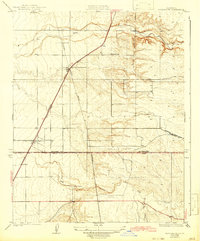
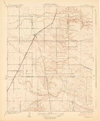
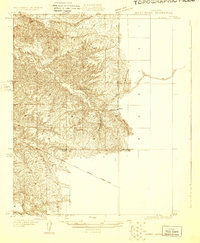
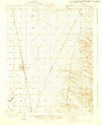
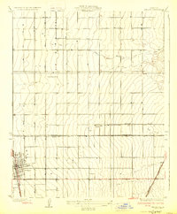
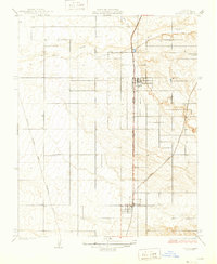
1929 Map of Richgrove
USGS Topo · Published 1942About this map
The Southern Pacific railroad corridor anchors this Central Valley survey, tracing a diagonal line through a landscape defined by early agricultural development and infrastructure. Recorded in 1926, the map captures the rural communities of Richgrove, Vestal, Quality, and Orris as they appeared before the extensive mid-century expansion of California's water systems. The Tulare Co Kern Co Boundary Line bisects the region, where the flat valley floor meets the undulating foothills drained by the White River and Rag Gulch.
Find a feature on this map
13 named features on this map. Tap any name to fly to it.
Don’t see what you’re looking for? This feature index may not catch every label — zoom into the map to look around manually.
Map Details
Editions of this 1929 Richgrove Map
3 editions found
Other maps of this area
1926 · Quincy School
USGS Topo · 1:31,680
1927 · McFarland
USGS Topo · 1:31,680
1929 · Delano
USGS Topo · 1:31,680
1929 · Sausalito School
USGS Topo · 1:31,680
1929 · Richgrove
USGS Topo · 1:31,680
1929 · Quincy School
USGS Topo · 1:31,680
1929 · Ducor
USGS Topo · 1:31,680
1930 · McFarland
USGS Topo · 1:31,680
1931 · Deepwell Ranch
USGS Topo · 1:31,680
1932 · Woody
USGS Topo · 1:62,500