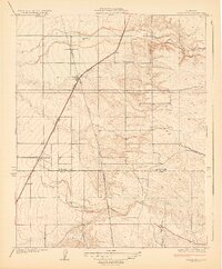
1929 Map of Richgrove
USGS Topo · Published 1929About this map
The border between Tulare Co Kern Co anchors this 1920s survey of the San Joaquin Valley's edge, where the Southern Pacific railroad and the Orange Belt Highway drive the layout of early rural settlements. The map captures the agricultural transition of the region, featuring small rail-aligned stops like Richgrove, Vestal, Orris, and Quality. The landscape shifts from the flat alluvial floor into the foothills to the east, dissected by seasonal watercourses such as the White River and Rag Gulch. Local landmarks like the Thermal Sch and Quinn Ranch provide specific touchpoints for genealogists researching the families who settled this citrus and grape-growing corridor. The presence of major infrastructure, including the California Edison Co Transmission Line, illustrates the early 20th-century development of the regional power and transportation grid essential to local industry.
Find a feature on this map
15 named features on this map. Tap any name to fly to it.
Don’t see what you’re looking for? This feature index may not catch every label — zoom into the map to look around manually.
Map Details
Editions of this 1929 Richgrove Map
3 editions found
Other maps of this area

1926 · Quincy School
USGS Topo · 1:31,680

1927 · McFarland
USGS Topo · 1:31,680

1929 · Delano
USGS Topo · 1:31,680

1929 · Sausalito School
USGS Topo · 1:31,680

1929 · Richgrove
USGS Topo · 1:31,680

1929 · Quincy School
USGS Topo · 1:31,680

1929 · Ducor
USGS Topo · 1:31,680

1930 · McFarland
USGS Topo · 1:31,680

1931 · Deepwell Ranch
USGS Topo · 1:31,680

1932 · Woody
USGS Topo · 1:62,500