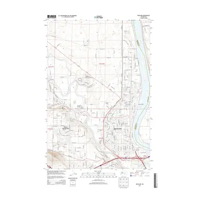
2014 Map of Richland
USGS Topo · Published 2014About this map
The confluence of the Columbia River and the Yakima River anchors this study of the Tri-Cities region, showing the sprawling residential and infrastructure development of Richland and West Richland. Modern transportation corridors including the Bypass Hwy and I-182 define the landscape, connecting the urban centers to points beyond while navigating the natural terrain of Candy Mtn and Flat Top Hill.
Find a feature on this map
37 named features on this map. Tap any name to fly to it.
Don’t see what you’re looking for? This feature index may not catch every label — zoom into the map to look around manually.
Map Details
Editions of this 2014 Richland Map
This is the sole edition of this map. No revisions or reprints were ever made.
Other maps of this area

1917 · Pasco
USGS Topo · 1:125,000

1951 · Richland
USGS Topo · 1:62,500

1953 · Walla Walla
USGS Topo · 1:250,000

1958 · Walla Walla
USGS Topo · 1:250,000

1964 · Kennewick
USGS Topo · 1:24,000

1964 · Pasco
USGS Topo · 1:62,500

1965 · Eltopia
USGS Topo · 1:62,500
1965 · Weber Canyon
USGS Topo · 1:24,000
1965 · Badger Mtn
USGS Topo · 1:24,000
1965 · Badger Mtn
USGS Topo · 1:62,500