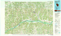
1985 Map of Richland Center
USGS Topo · Published 1991About this map
The Wisconsin River corridor dominates this mid-1980s landscape, winding through the driftless area of southwest Wisconsin. The map illustrates a region defined by deeply incised valleys and high ridges like Kickapoo Ridge and Maple Ridge, where the complex drainage of the Kickapoo River and Pine River dictates the pattern of small dairy-country settlements. The Chicago and North Western rail line follows the river valley floor, connecting the agricultural hubs of Boscobel, Muscoda, and Lone Rock. To the east, the sprawling Governor Dodge State Park and the distinct formation of Black Hawk Rock highlight the transition from bottomland to upland plateau. Large tracts of protected land, including the Lower Wisconsin River State Wildlife Area, preserve the expansive wetlands and sand prairies that have historically shaped local commerce and navigation.
Find a feature on this map
161 named features on this map. Tap any name to fly to it.
Don’t see what you’re looking for? This feature index may not catch every label — zoom into the map to look around manually.
Map Details
Editions of this 1985 Richland Center Map
This is the sole edition of this map. No revisions or reprints were ever made.
Other maps of this area

1900 · Lancaster
USGS Topo · 1:125,000

1901 · Denzer
USGS Topo · 1:62,500

1901 · The Dells
USGS Topo · 1:62,500

1902 · Mineral Point
USGS Topo · 1:125,000

1902 · Elkader
USGS Topo · 1:125,000

1903 · Waukon
USGS Topo · 1:125,000

1904 · Lancaster
USGS Topo · 1:125,000

1905 · Richland Center
USGS Topo · 1:125,000

1908 · Lancaster
USGS Topo · 1:125,000

1920 · Blue Mounds
USGS Topo · 1:62,500