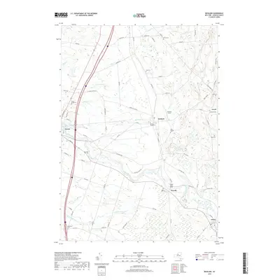
2019 Map of Richland
USGS Topo · Published 2019About this map
The Salmon River dominates this portion of Oswego County, winding through a landscape shaped by glacial topography and early New York settlement patterns. This modern 2019 survey documents the enduring layout of villages like Pulaski, Richland, and Altmar, alongside smaller hamlets such as Pineville and Orwell. The density of family and village burial grounds, including the Pulaski Village Cemetery and Richland Village Cemetery, offers a valuable resource for genealogists mapping the region's heritage.
Find a feature on this map
80 named features on this map. Tap any name to fly to it.
Don’t see what you’re looking for? This feature index may not catch every label — zoom into the map to look around manually.
Map Details
Editions of this 2019 Richland Map
This is the sole edition of this map. No revisions or reprints were ever made.
Other maps of this area

1895 · Pulaski
USGS Topo · 1:62,500

1903 · Orwell
USGS Topo · 1:62,500

1905 · Orwell
USGS Topo · 1:62,500

1905 · Mexico
USGS Topo · 1:62,500

1906 · Kasoag
USGS Topo · 1:62,500

1942 · Sandy Creek
USGS Topo · 1:24,000

1943 · Pulaski
USGS Topo · 1:31,680
1943 · Boylston
USGS Topo · 1:31,680

1943 · Richland
USGS Topo · 1:31,680

1943 · Mexico
USGS Topo · 1:31,680