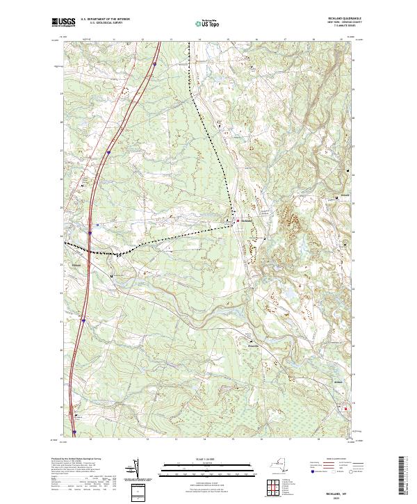
2023 Map of Richland
USGS Topo · Published 2023About this map
The Salmon River carves a winding path through this portion of Oswego County, shaping a landscape defined by its many tributaries and dispersed rural settlements. Near the village of Pulaski, the terrain transitions from the riverbanks to upland areas marked by numerous family and community burial grounds, including the Pulaski Village Cem and Riverside Cem. The importance of the river system to the local geography is evident in the convergence of Deer Creek, Spring Brook, and Trout Brook. Central to the map is the hamlet of Richland, which serves as a junction for local travel and the location of the Richland Airpark. This survey documents the modern road network, such as Co Rte 48 and Co Rte 22, which connect the outlying communities of Orwell, Pineville, and Altmar through a region primarily composed of wetlands and small watercourses like Little Grindstone Creek.
Find a feature on this map
80 named features on this map. Tap any name to fly to it.
Don’t see what you’re looking for? This feature index may not catch every label — zoom into the map to look around manually.
Map Details
Editions of this 2023 Richland Map
This is the sole edition of this map. No revisions or reprints were ever made.
Other maps of this area

1895 · Pulaski
USGS Topo · 1:62,500

1903 · Orwell
USGS Topo · 1:62,500

1905 · Orwell
USGS Topo · 1:62,500

1905 · Mexico
USGS Topo · 1:62,500

1906 · Kasoag
USGS Topo · 1:62,500

1942 · Sandy Creek
USGS Topo · 1:24,000

1943 · Pulaski
USGS Topo · 1:31,680
1943 · Boylston
USGS Topo · 1:31,680

1943 · Richland
USGS Topo · 1:31,680

1943 · Mexico
USGS Topo · 1:31,680