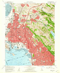
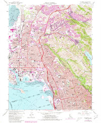
1959 Map of Richmond
USGS Topo · Published 1960About this map
The heavy industrial footprint of Richmond and the East Bay waterfront is clearly visible in this late 1950s survey. Extensive infrastructure including the Oil Tank Farm near San Pablo Bay and the busy Richmond Inner Harbor define the western shoreline. Inland, the map captures a period of intense post-war suburban growth as residential streets push east into the hills of San Pablo Ridge and up against the wilder terrain of Charles Lee Tilden Regional Park.
Find a feature on this map
100 named features on this map. Tap any name to fly to it.
Don’t see what you’re looking for? This feature index may not catch every label — zoom into the map to look around manually.
Map Details
Editions of this 1959 Richmond Map
5 editions found
Other maps of this area

1895 · San Francisco
USGS Topo · 1:62,500

1896 · Carquinez Strait
USGS Topo · 1:62,500

1897 · Concord
USGS Topo · 1:62,500

1898 · Karquines
USGS Topo · 1:62,500

1899 · San Francisco
USGS Topo · 1:62,500

1901 · Karquines
USGS Topo · 1:62,500

1902 · Napa
USGS Topo · 1:125,000

1915 · Concord
USGS Topo · 1:62,500

1915 · San Francisco
USGS Topo · 1:62,500

1916 · Mare Island
USGS Topo · 1:62,500