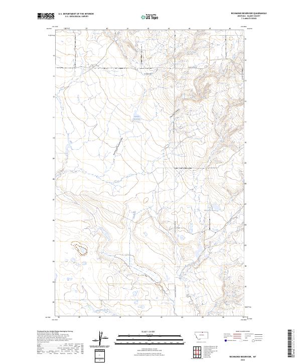
2024 Map of Richmond Reservoir
USGS Topo · Published 2024About this map
The northern Montana plains in Blaine County define this landscape, where seasonal water management and drainage patterns are the primary markers of human activity. Named water bodies like Richmond Reservoir and Harbolt Reservoir suggest a pastoral economy dependent on captured runoff in a semi-arid environment. The terrain is deeply incised by a network of drainage systems, including Chouteau Coulee and its North Fork, which carve through the high prairie towards larger basins.
Find a feature on this map
13 named features on this map. Tap any name to fly to it.
Don’t see what you’re looking for? This feature index may not catch every label — zoom into the map to look around manually.
Map Details
Editions of this 2024 Richmond Reservoir Map
This is the sole edition of this map. No revisions or reprints were ever made.
Other maps of this area

1904 · Chinook
USGS Topo · 1:62,500

1905 · Harlem
USGS Topo · 1:62,500

1912 · Zurich
USGS Topo · 1:125,000

1913 · Cherry Ridge
USGS Topo · 1:125,000

1953 · Havre
USGS Topo · 1:250,000

1957 · Havre
USGS Topo · 1:250,000

1958 · Havre
USGS Topo · 1:250,000

1964 · Rabbit Hills
USGS Topo · 1:24,000

1984 · Richmond Reservoir
USGS Topo · 1:24,000
1984 · Richmond Reservoir SW
USGS Topo · 1:24,000