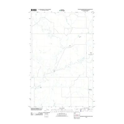
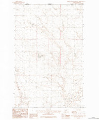
2011 Map of Richmond Reservoir NW
USGS Topo · Published 2011About this map
East Fork Battle Creek meanders across this northern Montana landscape, defining the drainage patterns of a region shaped by a complex system of coulees. The terrain is marked by significant topographical depressions and dry creek beds, including Lyons Coulee and Corral Coulee, which reflect the erosional history of the area. Human intervention in this arid environment is evident through water management structures such as Haystack Dam and Cloudy Dam, essential for local ranching or agricultural stability. A sparse network of rural roads, including Anita Rd and Sage Rd, provides the primary access through these breaks and uplands, connecting remote family landholdings and grazing areas across the Montana-Saskatchewan border region.
Find a feature on this map
12 named features on this map. Tap any name to fly to it.
Don’t see what you’re looking for? This feature index may not catch every label — zoom into the map to look around manually.
Map Details
Editions of this 2011 Richmond Reservoir NW Map
This is the sole edition of this map. No revisions or reprints were ever made.
Other maps of this area

1912 · Zurich
USGS Topo · 1:125,000

1953 · Havre
USGS Topo · 1:250,000

1957 · Havre
USGS Topo · 1:250,000

1958 · Havre
USGS Topo · 1:250,000

1984 · Richmond Reservoir
USGS Topo · 1:24,000
1984 · Richmond Reservoir SW
USGS Topo · 1:24,000

1984 · Havre
USGS Topo · 1:100,000
1984 · Richmond Reservoir NE
USGS Topo · 1:24,000
1984 · Richmond Reservoir NW
USGS Topo · 1:24,000
1984 · North Chinook Reservoir NE
USGS Topo · 1:24,000