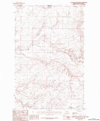
1984 Map of Richmond Reservoir NE
USGS Topo · Published 1984About this map
Saskatchewan Montana borderlands define this 1984 provisional survey, capturing a remote stretch of the international boundary between Canada and the United States. The landscape is dominated by the complex drainage systems of Battle Creek and its tributary, the East Fork Battle Creek, which carve through the high plains of north-central Blaine County. Notable topographic depressions and seasonal watercourses such as Sand Coulee in the northwest and Corral Coulee in the south reveal the natural erosion patterns characteristic of this arid region. This document serves as an essential record of the physical geography and hydrography along the 49th parallel during the late twentieth century, showing a terrain largely defined by its water-carved coulees and the straight-line political boundary that bisects them.
Find a feature on this map
7 named features on this map. Tap any name to fly to it.
Don’t see what you’re looking for? This feature index may not catch every label — zoom into the map to look around manually.
Map Details
Editions of this 1984 Richmond Reservoir NE Map
This is the sole edition of this map. No revisions or reprints were ever made.
Other maps of this area

1912 · Zurich
USGS Topo · 1:125,000

1913 · Cherry Ridge
USGS Topo · 1:125,000

1953 · Havre
USGS Topo · 1:250,000

1957 · Havre
USGS Topo · 1:250,000

1958 · Havre
USGS Topo · 1:250,000

1984 · Richmond Reservoir
USGS Topo · 1:24,000
1984 · Richmond Reservoir SW
USGS Topo · 1:24,000
1984 · Silver Bow Lake
USGS Topo · 1:24,000

1984 · Havre
USGS Topo · 1:100,000
1984 · Irvins Coulee
USGS Topo · 1:24,000