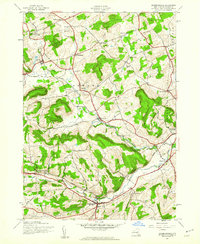
1944 Map of Richmondville
USGS Topo · Published 1960About this map
Richmondville and Cobleskill anchor this mid-century topographic record of Schoharie County, which highlights the deeply carved valleys and hollows of central New York during the 1940s. The Delaware and Hudson railroad serves as the primary artery through the landscape, following the course of the West Delaware AND Hudson Creek and connecting rural outposts like Hyndsville and Warnerville. This survey reveals a remarkably dense network of local landmarks, including one-room schoolhouses like School No 14 and School No 6, alongside numerous family and community burial grounds such as Peoples Cem and Beekman Cem. Small crossroads settlements including Beekman Corners, Zeh Corners, and Gardnersville punctuate the agricultural uplands, while landmarks like St Johns Ch and Fuller Pond provide specific points of reference for genealogists and local historians tracing the heritage of the Sharon, Seward, and Richmondville townships.
Find a feature on this map
37 named features on this map. Tap any name to fly to it.
Don’t see what you’re looking for? This feature index may not catch every label — zoom into the map to look around manually.
Map Details
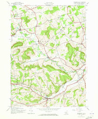
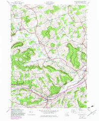
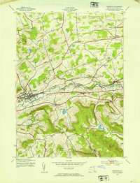
Editions of this 1944 Richmondville Map
4 editions found

Other maps of this area

1896 · Fonda
USGS Topo · 1:62,500

1898 · Fonda
USGS Topo · 1:62,500

1898 · Canajoharie
USGS Topo · 1:62,500

1898 · Schoharie
USGS Topo · 1:62,500

1900 · Canajoharie
USGS Topo · 1:62,500

1900 · Schoharie
USGS Topo · 1:62,500

1902 · Canajoharie
USGS Topo · 1:62,500

1902 · Fonda
USGS Topo · 1:62,500

1904 · Richmondville
USGS Topo · 1:62,500
1943 · Cobleskill
USGS Topo · 1:24,000